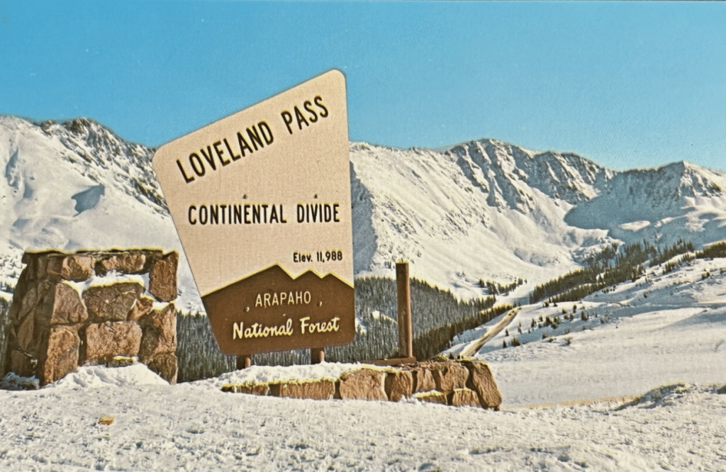
Crossing the Continental Divide.
I grew up in Colorado before I-70 went all the way through the state. This meant that the most direct route to Grand Junction from Denver was to drive over the Continental Divide via Loveland Pass – the actual Pass on highway 6 – not through Eisenhower Tunnel. (see route in red on map below)
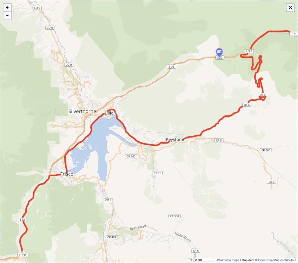
Route (in red) over Loveland Pass, Colorado 1960s
The Trip
This was the 1960s and we kids rode in the backseat of the car, or during the summer (shocker) in the back of a pickup truck that had big plywood sideboards around the bed. There were no seatbelts or restraints of any kind, we were totally untethered. It was fun, but it could turn dangerous quick – even in good weather.
The trip from Denver to Grand Junction took 9 hours – 9 hours! The reason it took that long was because we had to go through every teeny tiny little town on highway 6 and 24 – which basically are today’s frontage roads along I-70. We did that drive a lot because that’s where most of dad’s family lived.
Anyway, one scary part (and there were a few), was driving over Loveland Pass.
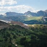
The summit is very high altitude – anywhere from two to twelve feet shy of 12K feet – depending on the year each new sign got put up.
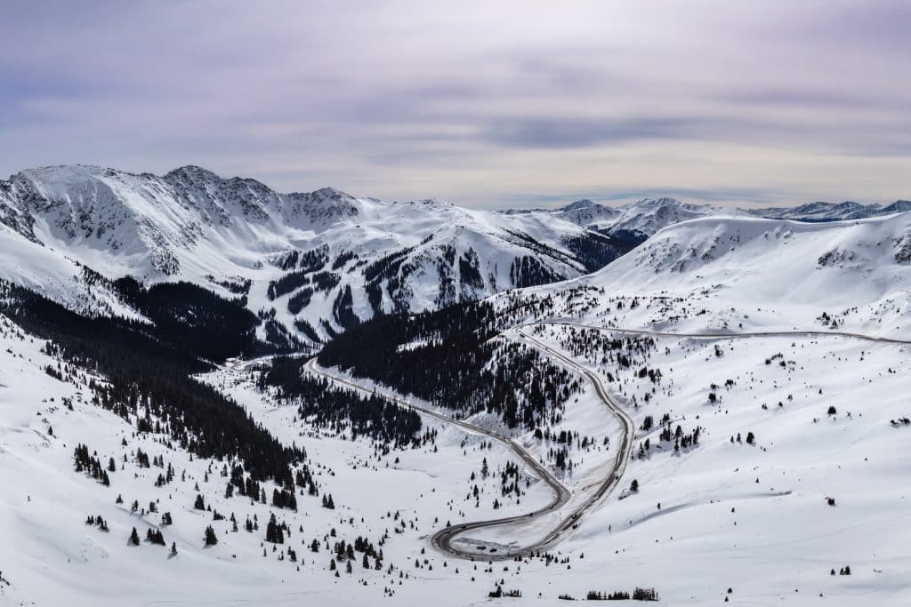
Winter on Loveland Pass
During the winter it was particularly unnerving when the hairpin curves were covered in ice and snow.
Back then there were no satellite imaging apps so dad would check the weather on TV or in the newspaper the night before we left Denver. The next morning we’d all pile in the car around 5:30 to 6:00am and head out.
The weather in the high country can literally change in minutes without warning no matter how much you planned. And there was the constant risk of avalanches and landslides that could happen at any moment so it could get tricky really fast.
If it was snowing when we got to the pass (and if still open) dad would look up at the sky, check out the clouds, and gauge the wind speed and direction. Depending on what he saw and felt, he’d either turn around and we’d go back home or chain up the tires (with actual chains) and we’d continue on. Big bonus if the road had been recently sanded.
The road crews did a great job keeping it open, but if it got too bad they’d shut the road down at the bottom. If you were already up there in the blizzard, you were kind of hosed. It happened to us more than once and our only hope was to try and make it down safely.
Driving up the Pass
So, off we’d go – up and over the pass hoping the trip down the other side would be uneventful – totally old school.
The road was only 2 lanes and rather narrow. It’s approximately 8.7 miles one-way to the summit from the base. The numerous tight turns made it really slow going. Fortunately, there weren’t as many cars and big trucks on the road as there are today.
There were no guard “rails” on the pass either because the road wasn’t wide enough. What were there consisted of a few 8 inch round wooden posts sticking about 3 feet out of the ground placed around a few hairpin turns or on certain straightaways.
Sometimes they had heavy steel cable tying them together – but not always. Sometimes it was just the white posts with reflective stripes painted on them and nothing in between, you know… super safe.
I’d like to mention here, that cars and trucks at the time were made out of heavy-gauge steel. There were definitely pros and cons to that for sure.
One key “pro” was that the vehicles were very heavy and could drive through snow fairly well staying weighted down.
One big “con” however, was if a heavy steel car or truck started sliding out of control – even IF there happened to be any guard “posts”, well… steel cable strung through some wood posts and no seatbelts? – good luck.
Glimpses of Reality
Driving westbound meant that our car was on the downhill side of the pass, so on sunny days, we could look out the passenger-side window and peer down over the edge of the road.
In certain places, I remember seeing old cars below – some from the 50s and even the 40s – all dented up and rusty. They had slid out a long time ago.
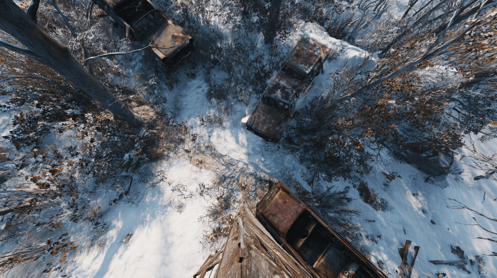
(Disclosure: I created the next two images using AI because I don’t have the photos from back then – they’re pretty accurate though.)
Some of these cars were still hanging in the branches of big, old-growth trees. All of them were in places that tow trucks just couldn’t reach so they left them there.
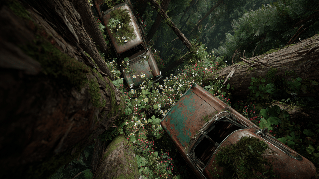
It always made me wonder what the road conditions must have been like when they slid out and fell into the trees.
Was it slick with rain or snow? Were they avoiding an animal that walked onto the road? And… how many people actually survived the ordeal while waiting for help to show up?… especially in the winter.
Seeing those cars down there was certainly a stark reminder of the reality of that drive. Paying strict attention to the road was top priority when traveling over any mountain – no matter the season.
High Mountain Blizzards
Unfortunately there were times when we got caught in a few blizzards. Whenever that happened, us kids would lie on the floor of the backseat with a blanket over our heads so we wouldn’t have to see what was going on – especially at night when the snow hitting the windshield became hypnotic. Too scary!!

Even with our heads covered, we could still feel when the car slipped or worse yet – fishtailed on some ice!
Dad would say a few swear words and you could hear Mom inhale quickly, but there was NO screaming coming from the backseat. The very last thing he needed was 3 kids freaking out behind him making it hard to concentrate. Nope – not a peep. Screaming was only allowed if we were sliding off the road to our doom – LOL!
Dad just kept moving forward, it was that or be stuck on the side of the road only to be slowly buried by snowfall. If that happened his next worry was avalanches or the snowplows that would eventually come and possibly plow into you! But he always got us through – he was an amazing driver.
He used to drive logging trucks in those mountains in his youth, and he knew some solid tricks. Fortunately, he passed those driving tips on to us years later when he taught us how to drive. They came in really handy no matter where we drove; mountain passes, plains, winter or not. They certainly saved my butt on several occasions – whew!
We ALWAYS trusted him behind the wheel – all the way to when he decided to quit driving in his 80’s.
Once we made it to the summit, (depending on weather) he’d stop so we could all take a break. If it was still snowing, he’d just keep going down the other side which was another 8 miles at a steep 7% descent. By the time we got completely off the pass and into Keystone we were all breathing a little easier. We survived!! Again!!
The next bit was to drive over Dillon Dam and wind our way into Frisco where we’d stop and get something to eat – whew! Then it was back in the car, onto the existing section of I-70 west and we braced ourselves to go over Vail Pass next – oh yay. Not as bad as Loveland but still icy and a little scary.
So anyway…
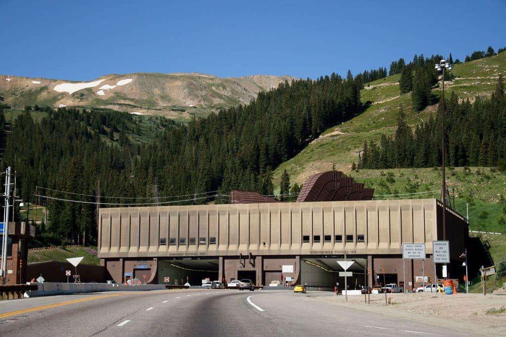
Today, we have the Eisenhower Tunnel
Nerd Notes About the Tunnel
The official name of the tunnel is the “Eisenhower – Edwin C. Johnson Memorial Tunnel”. It’s a mouthful to say so everyone just calls it “Eisenhower Tunnel”.
It’s actually a pair of tunnels called “bores” that were built at separate times. Both tunnels have 2 lanes each.
The first to open was the westbound bore that took 5 years to complete (1968 -1973). It was named for U.S. President Dwight D. Eisenhower.
The eastbound bore took another six years and was named for Edwin C. Johnson – Colorado’s Governor and U.S. Senator who lobbied for an Interstate Highway to be built across Colorado. Thanks Ed 😁
Trucks carrying hazardous materials are still rerouted over the old pass to this day.
Fun Fact
It’s the highest vehicular tunnel in the world and, it’s the highest point on the U.S. Interstate Highway System at 11,158 feet above sea level.
Our First Trip Through the Tunnel
Since we went to Grand Junction a lot, of course we went through the tunnel the weekend it opened. It was AMAZING! Modern engineering at its finest.
The first thing we noticed entering the tunnel were the shiny white tiles that cover the entire 1.7 mile (2.7km) long interior – very clean and new. The lighting was bright throughout, so it really woke us up.
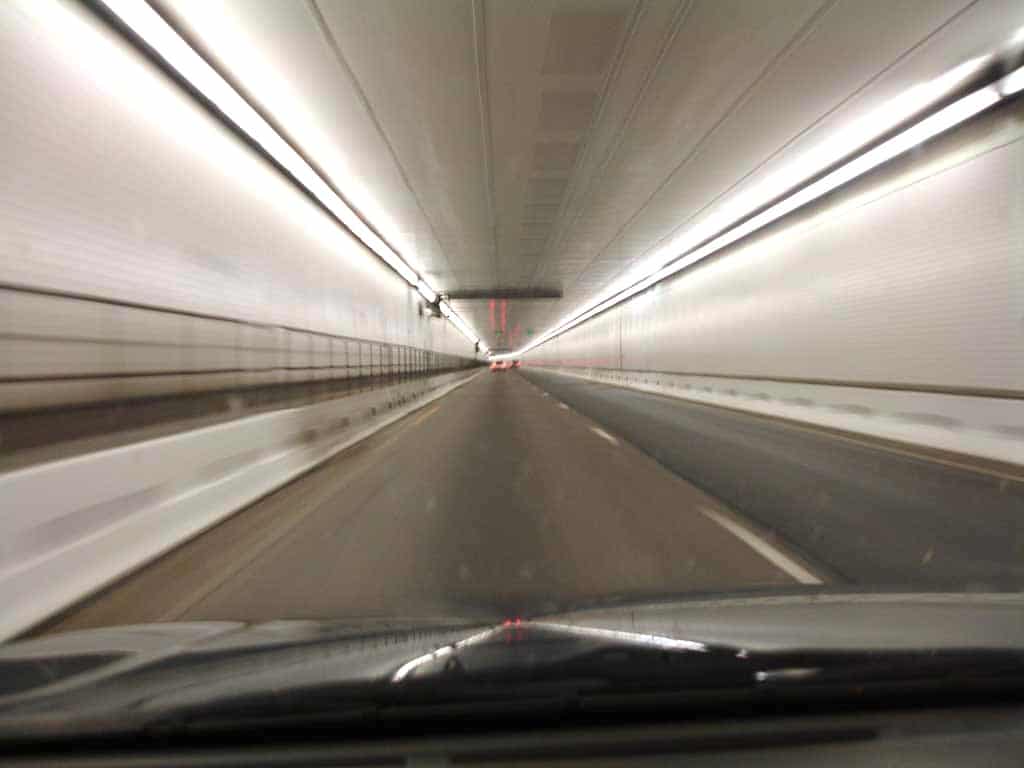
Additionally, there was a narrow walkway with a railing built for maintenance workers on one side running the entire length of the tunnel. Every so often we’d see little doors with signs above them that read “Telephone” where you would find a phone in case you broke down and needed help.
When we finally came out on the western side (it took forever it seemed – 1.7miles), we were treated to a spectacular view of the valley below and the mountains to the west that we still had to cross.
This new fancy tunnel was so much faster than going over the actual pass – not to mention less scary. But then, we had to drive down towards Dillon which could be a real slider too if you weren’t careful. Both the westbound and eastbound sides open onto a steep 7% downhill grade road – yikes!
Over the years I would come to find out firsthand, that driving out of the tunnel in the winter can be just as dangerous as the old pass was no matter which side you exit from.
But getting back to the actual pass…
For All You Slow Travelers Out There
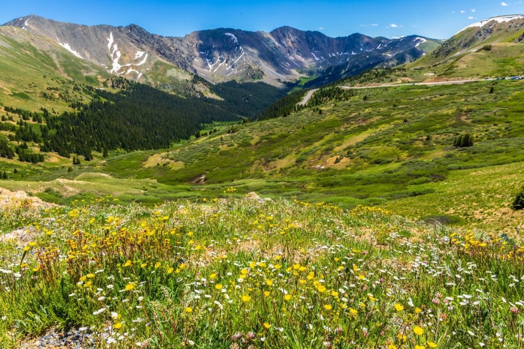
If you have the time, I highly recommend driving the old Loveland Pass road over the Continental Divide (preferably in the summer or autumn) rather than taking the tunnel. It’s a beautiful drive with stunning vistas. Plus, there’s a place to park at the summit to take a break and stretch your legs.
Now I have a question for you… “Do you have a stretch of road from your childhood that you remember with a mix of awe and terror?” I’d love to hear your ‘taking the long way’ stories in the comments below.
To Quote my Dad:
“Let’s go for a ride and see where we end up.”
Thanks for being here.
Photo Credits
Loveland Pass, CO Map: By Wikimedia Maps / OpenMaps [Altered Map – Route Marked with Red]
https://en.wikipedia.org/wiki/Eisenhower_Tunnel#/map/1
1960s Postcard: JessPassingThrough
Eisenhower Tunnel Exterior: By Patrick Pelster (selbst fotografiert) – de:Datei:Eisenhower_Tunnel.JPG, CC BY-SA 3.0, https://commons.wikimedia.org/w/index.php?curid=7890186
Eisenhower Tunnel Interior: By James Reyes – Wikimedia (public domain)
Other Images: Adobe Stock
AI Cars in Trees: Midjourney
Views: 13